Recreational Land & Farm for Sale in Burns, Oregon
T24S R31E Wm Tax Burns, OR 97720
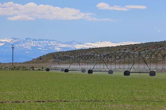


Narrows Pivots
Approx. 28 miles South of Burns Oregon off of 205 on Sod House Lane
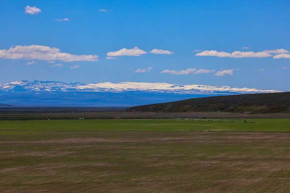
This Eastern Oregon farm is south of Burns Oregon nestled in a picturesque valley with a tapestry of the Steens Mountains & agricultural prosperity. The landscape consists of slight hillsides on the west & south portion of the deeded that overlook the valley floor where the irrigated rest. The farm has a total of 760 deeded acres with 340 acres in water rights under 3 pivots. The irrigation is done by 5 wells with 2 having hot water.
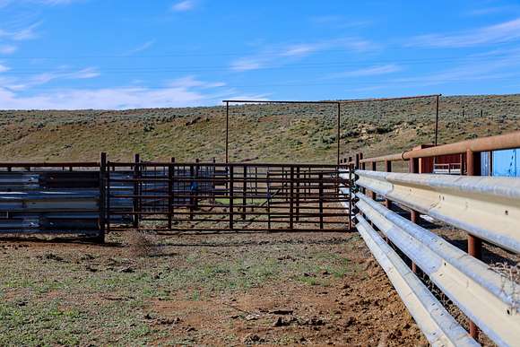
The property borders thousands of acres of public BLM ground as well as the Malhuer Wildlife Refuge. The irrigated fields are currently planted into a mixture of oats, peas, turnups, clover, & annual grasses. There is a bunk house on the property and a good set of steel working corrals set up with alleys from different grazing pastures to make it a swifter process of cattle handling facility.
This is truly a unique property with an amazing setting, plus it has its own private cinder pit for roads & pivot tracks.
A total of 340 acres are irrigated by 3 pivots, 2 Reinke, 1 Zimmatic, one of which has a LESA system to optimize water evaporation. The pivots are all interconnected with the mainlines & tied into the 5 wells. The 3 pivots are all currently planted into a mixture of oats, peas, turnups, clover, & annual grasses.
This area has a longer growing season for hay & alfalfa due to the warmer climate compared to the other areas around Burns.
The improvements on the premise are mostly storage with a couple of train carts. There is a bunk house that has been used during calving season for a close place to rest between the fields & pasture ground. A steel set of working corrals works great with alleys leading from different pasture fields to allow a working area to sort & load. The owner currently uses a portable loading chute.
The owners have a cinder pit on the deeded they use for their roads, pivot tracks, & more.
LEGAL: T27S R31E W.M. Tax Lots 503, 1200, 1300
ACREAGE: 760+/- Deeded Acres - Per County Records
- 340+/- Acres Pivot Irrigated
- 418 +/- Acres Dryland Pasture
- 2 +/- Acres Improvements
WATER RIGHTS:
Certificate# #Acres Priority Date SOURCE G-15355(Permit) 130 July, 1 2002 Well
92228 210 June 17, 2008 Well
FINANCING: Cash or Bank Financing
TAXES: $1,743.37 - Per County Records (Farm deferral)
Property details
- County
- Harney County
- Elevation
- 4,114 feet
- Date Listed
Listing history
| Date | Event | Price | Change | Source |
|---|---|---|---|---|
| May 18, 2024 | New listing | $1,775,000 | — | — |